Nor'easter closes NC-12 to Hatteras: the island's only road is still shut Wednesday, flood warnings extended
Ocean overwash and dune erosion near the Pea Island Visitor Center forced the North Carolina Department of Transportation to close NC-12 from the Marc Basnight Bridge to Rodanthe on Monday evening; the National Weather Service's Wednesday morning update still listed the segment closed, with the coastal flood warnings for Hatteras and Ocracoke extended through 8 p.m. Wednesday.
Summarized from Public Radio East.
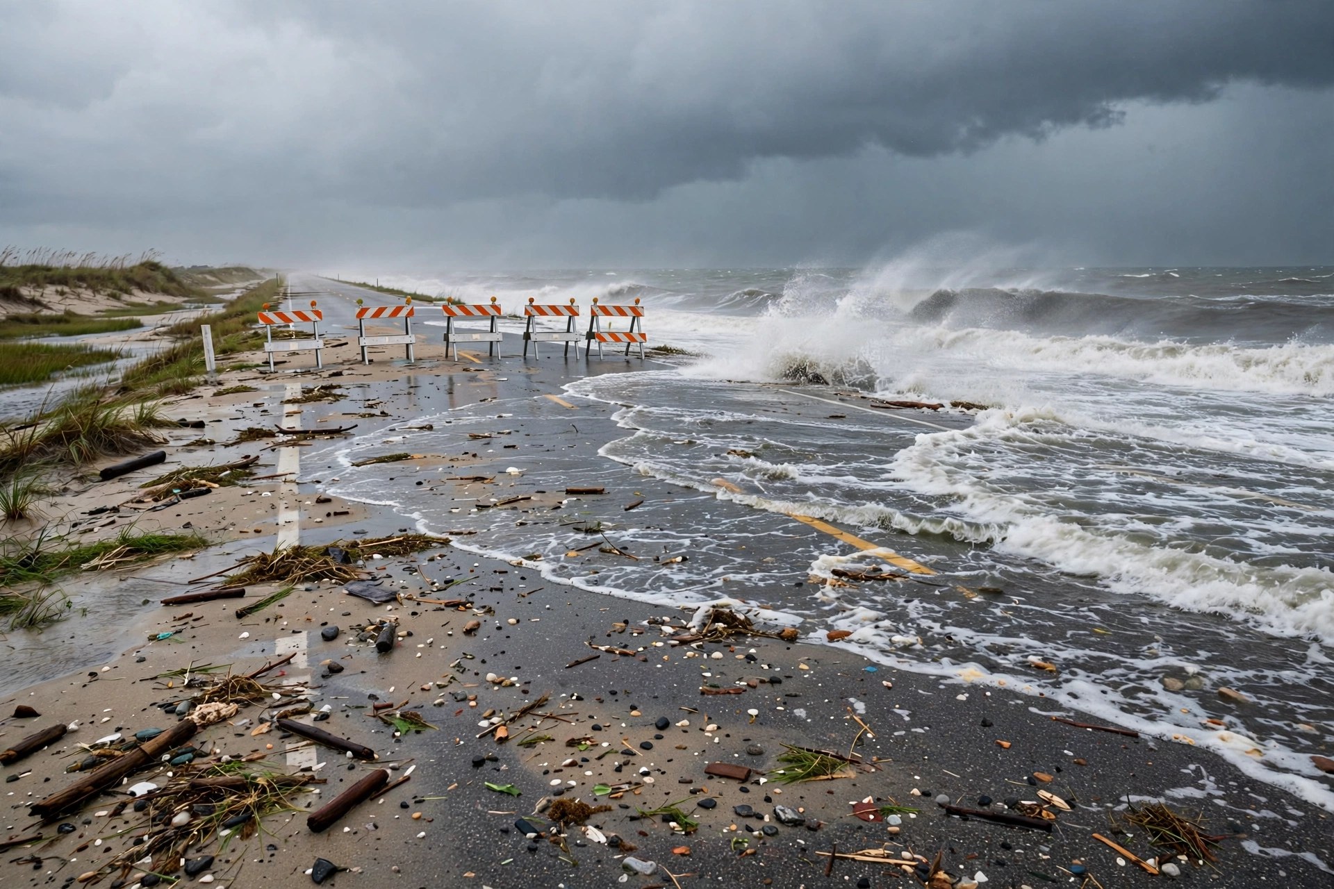
The slow-moving nor'easter off the North Carolina coast has done what forecasters warned it could: it has closed NC Highway 12, the only road connecting Hatteras Island to the mainland, according to Public Radio East on Oct. 20, reporting North Carolina Department of Transportation updates. The road was still closed early Wednesday, according to the National Weather Service office in Newport/Morehead City in its 4:11 a.m. Wednesday update.
The department announced the closure — from the Marc Basnight Bridge to Rodanthe — on Monday evening, after continuous waves caused severe dune erosion and pushed massive amounts of sand and ocean water across the pavement near the Pea Island Visitor Center. Crews worked to fortify barriers but had to halt operations when conditions became too dangerous. Dare County confirmed the closure in its Tuesday bulletin and kept the mandatory evacuation order for Hatteras Island visitors in effect; incoming traffic is blocked, and officials warn drivers never to bypass emergency barricades. The National Weather Service office in Newport/Morehead City, in its 4:11 a.m. Wednesday update, still listed the segment as closed, warned that people could be stranded on Hatteras for multiple days, and gave no reopening time.
The warnings have grown longer, not shorter. The coastal flood warnings for Hatteras and Ocracoke now run through 8 p.m. Wednesday — 27 hours beyond the Tuesday afternoon ending in effect when the storm arrived — with 2 to 4 feet of inundation above ground level expected in low-lying areas near shorelines and tidal waterways, and other vulnerable stretches of NC-12 at risk of flooding around high tide. The storm is driving gusts of 45 to 55 mph and throwing massive breaking waves at the coast, and forecasters expect severe coastal flooding and extreme high tides to plague the barrier islands through at least Wednesday.
Ocracoke Island is cut off the other way: the state has suspended all coastal ferry routes in dangerous sea conditions, with 14-foot breaking waves reported. Farther south, the Crystal Coast is taking flooding and heavy wind as well — a wind advisory remains in effect in Carteret County, where the weather service expects 1 to 3 feet of soundside inundation in low-lying areas of Downeast Carteret County and along the Neuse River basin, with offshore swells reaching up to 18 feet.
State transportation and emergency officials say they will evaluate the highway damage and determine next steps as soon as conditions allow. Until then, Hatteras Island's only road link is severed: deliveries, service calls and any trip on or off the island wait on the tide clock, and drivers headed for the Outer Banks should not travel toward the island.
Sources
Related coverage
 October 18, 2026 · Weather and roadsNor'easter takes shape off the Carolinas: gusts over 60 mph, a coastal flood warning and NC-12 overwash risk into Tuesday
 October 17, 2026 · Weather and roadsColdest day in months hits the Great Lakes and Northeast Saturday, with 25-40 mph gusts and wet snow
 October 15, 2026 · Weather and roadsSeason's first winter storm brings snow and 45 mph gusts to I-80 in Wyoming and Colorado's high passes
Comments
Loading comments…