NC-12 damage put at 800 feet of pavement and 1,800 feet of dunes; emergency ferry in planning and no reopening timeline
The North Carolina Department of Transportation now reports about 800 feet of pavement damage near the Pea Island Visitor Center — waves undermined the roadway — and about 1,800 feet of protective dunes lost, with the department in the planning stages of activating the Stumpy Point–Rodanthe emergency ferry and no timeline for reopening until overwash subsides and a full assessment is possible.
Summarized from The Outer Banks Life.
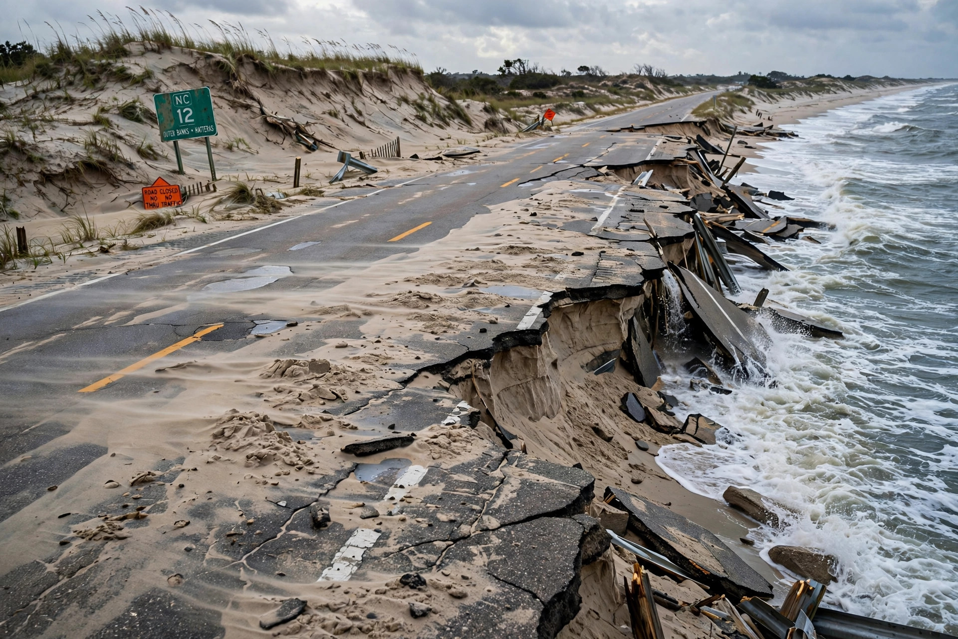
NC Highway 12 remains closed between the Marc Basnight Bridge and Rodanthe — and the damage is now measured, not just described, according to The Outer Banks Life on Oct. 21, reporting Dare County and North Carolina Department of Transportation updates. The department reports approximately 800 feet of pavement damage near the Pea Island Visitor Center, where persistent waves have undermined the roadway, and approximately 1,800 feet of protective dunes lost in the same area, with significant wind-blown sand accumulated in the Canal Zone.
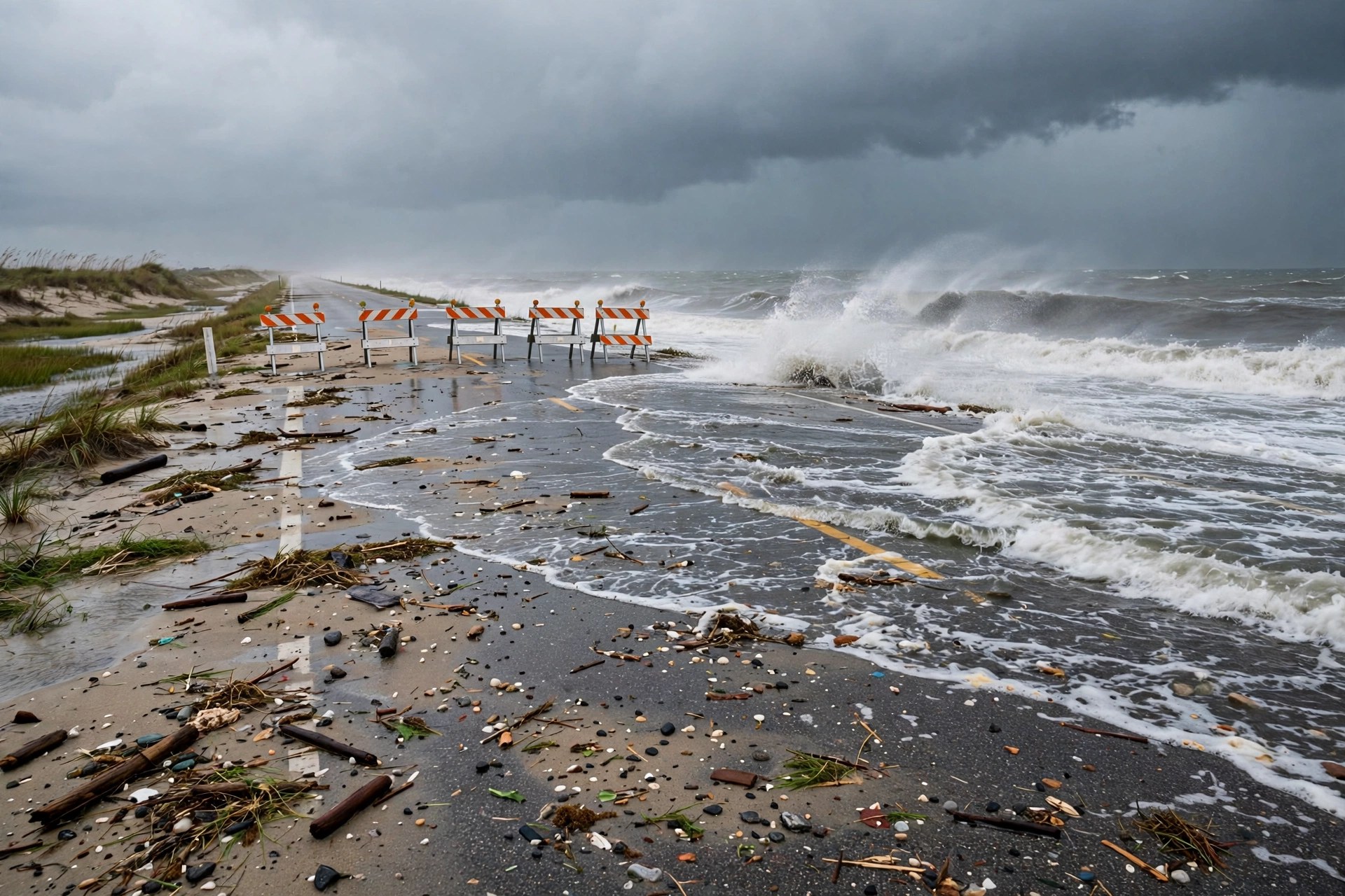
There is still no reopening date, and there cannot be one yet. Additional high tide cycles and continued ocean overwash must subside before the department can fully assess the damage and determine what repairs are needed; a timeline for reopening cannot be established until that assessment is complete. Dare County is coordinating closely with the department, which is in the planning stages of activating the emergency ferry route between Stumpy Point and Rodanthe — the relief route for Hatteras Island when its only road is cut. The department will announce departure schedules if the route is activated.
The water is not done. According to the National Weather Service, coastal flooding and ocean overwash will continue through Thursday, Oct. 22, and water levels during the high tides around 4:30 p.m. Wednesday and 5 a.m. Thursday could be similar to or higher than those already experienced, with further flooding, erosion and overwash possible. Winds are expected to ease Thursday and seas to gradually subside, but minor soundside flooding remains possible, particularly on southern Hatteras Island.
Dare County's state of emergency and the mandatory evacuation order for Hatteras Island visitors remain in effect, and visitors are not permitted to enter the island. Residents should prepare for the possibility that roadway access will remain unavailable for multiple days, and trash collection on Hatteras Island is suspended until the highway is safe for travel. Do not attempt to travel on the closed section or drive around barricades.
Sources
Related coverage
 October 21, 2026 · Weather and roadsNor'easter closes NC-12 to Hatteras: the island's only road is still shut Wednesday, flood warnings extended
 October 18, 2026 · Weather and roadsNor'easter takes shape off the Carolinas: gusts over 60 mph, a coastal flood warning and NC-12 overwash risk into Tuesday
 October 17, 2026 · Weather and roadsColdest day in months hits the Great Lakes and Northeast Saturday, with 25-40 mph gusts and wet snow
Comments
Loading comments…